Creating building footprint from LIDAR data
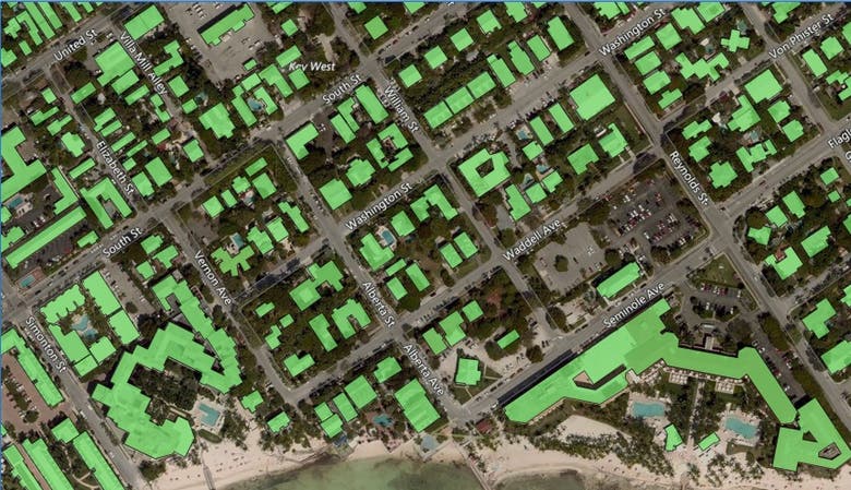
The point of this project was to create building footprint from unclassified LIDAR data of Key West.

Tentang Saya
Faculty of Civil Engineering - University of Belgrade Efficiently and quickly solve a lot of problems about GIS, Cartography, etc. I have a broad range of experience in: - collecting data and calculating mapmaking information to use in performing computations and computer-aided drafting; - Real Estate Cadastre and digital maps; - Excellent working knowledge of GIS, cartography, and geography; - Ability to create shapefiles and geo-database; - Converting all kinds of digital formats; - Skilled in image processing and geospatial production techniques; - Expert in collecting, compiling, and processing source materials for digitizing; - Autodesk Civil 3D, Autodesk AutoCAD, etc… - Strong communication, presentation, and organizational skills.